It is well known that good blast design ensures an effective distribution of powder that improves blast results and reduces drilling and blasting costs. Now, through the use of unmanned aerial vehicles (UAVs or drones), global positioning systems (GPS) and three-dimensional (3D) photogrammetric software, the field of blast design has been taken another step forward.

It is well known that good blast design ensures an effective distribution of powder that improves blast results and reduces drilling and blasting costs. Now, through the use of unmanned aerial vehicles (UAVs or drones), global positioning systems (GPS) and three-dimensional (3D) photogrammetric software, the field of blast design has been taken another step forward.
At the heart of this technical advance is the ability to conduct high-quality 3D face profiling using stereographic image pairs, providing accurate and detailed information for better drilling and charging designs that optimise powder distribution and reduce the risk of fly-rock.
The high-quality images also provide good visual assessments and measurements of block conditions and blast results – often not achievable from the blast elevation or from fixed elevated viewpoints. This information is particularly useful to pit-managers, mine surveyors, planning engineers and blasting consultants.
Working in a number of SA mining operations – in collaboration with US expert Robert McClure of RAM Inc and Terracam (Pty) Ltd – BME has been combining these technologies to more effectively quantify blast parameters including drilling quality, block geometry, back damage, heave profile and fragmentation evaluation.
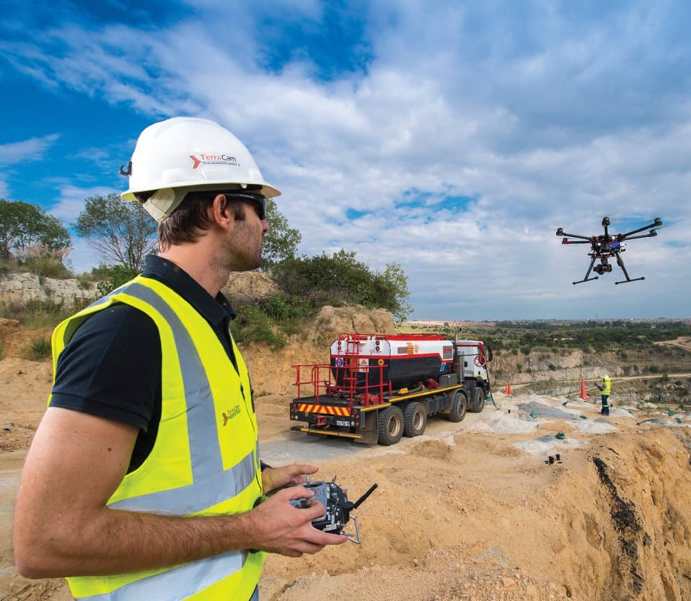
The approach involves the use of small fixed-wing drones (or multi-copters to deliver oblique views) that are pre-programmed to fly a grid across a particular area of interest on the mine site. This is done before and after a blast, to create accurate and measurable 3D images for analysis.
Due to the evolution of modern, high energy-density lithium polymer batteries, UAVs have become smaller and more affordable; and with reliable satellite navigation, they can safely fly aerial photographic surveys for up to an hour.
Equipped with small, high-resolution (10-20 megapixel) digital cameras, a fixed-wing drone can fly at low altitudes and deliver high-precision, geo-referenced orthophotos of the blast area. Still images are taken at intervals so that there is sufficient overlap to generate a 3D topographic surface, with accuracy relying on the placement of surveyed ground control points with sufficient elevation variance. The projects in South Africa consistently achieve vertical and horizontal accuracies less than 100 mm with a minimum of four ground control points.
Once this field information has been collected, analysis is quick and effective; by incorporating the options into a single package, a mine can manage their site with more confidence – making decisions with the most up to date information. Two software applications are required: one to generate a 3D surface orthophoto from the UAV images, by creating dense and filtered 3D data in any format from ASCII point clouds to raster GeoTIFFs or ECWs; and survey software to analyse volumes, cut-lines and surfaces.
The type of blast-specific information obtained from the photographs are: pre-blast block condition and volumes; blast-hole positions; and post-blast analysis of muck pile shape, back damage and fragmentation.
The information is valuable not only for reporting purposes but for assessing blast performance by examining the distribution of fragmentation and fly rock around a blast. As these are orthophotos with geo-referenced points, measurements can be made directly off the images. The view from directly above a blast is unique as it is possible to see and measure features that are not necessarily obvious from any other angle.
Muckpile profiles can also be created, allowing a geo-referenced, 3D digital surface to be analysed easily for volumes and cross-sections. Accurate vertical cross-sections are generated quickly from cut-lines drawn on the surface in the survey software.
For blast planning purposes, block-shape, hole locations and areas of damage are variables that can be accessed from the data. The position of holes can be detected from an orthophoto and saved as text-delimited files for use in blast planning software.
Rock variation in a bench often has a significant impact on blastability and explosives performance, and it is sometimes necessary to place waste or air decks in a hole traversing a sequence of strata in specific locations to concentrate or dilute the explosives energy. To address these issues, the new drone-based techniques also allow a closer inspection of the blast area’s geology. A scaled image of a face taken from a multi-copter provides a good source of information on the positioning and variation in width of strata in a single bench for charge planning purposes.
BME’s experience from mining projects in SA has shown the usefulness of using drones to leverage existing photographic, software and GPS technologies to improve blasts; there is no doubt that this science has plenty of potential yet to be uncovered.